

7.2 Airport Characteristics
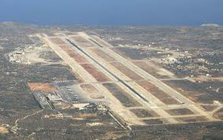 As a new NWS forecaster who may have never issued an aviation forecast before, there are some airport characteristics and geography you need to be familiar with before preparing your first aviation forecasts. These include geographical features (mountains, oceans, lakes, etc.,) or micrometeorology influences (vegetation, soil type, etc.,) that may impact local weather conditions.
Your Aviation Focal Point or forecasters in your office should be able to answer the following questions:
- Are there any geographical features (mountains, ocean, lakes, rivers, etc.,) near the airport that make it more prone to phenomena like fog and low clouds, cross winds, sea/land breezes, etc.?
- Is the airport located near a river or ocean? Are the weather conditions impacted by a marine layer?
- Are there mountains close by that create valley winds or influence precipitation types?
- Is there an urban heat island effect caused by a nearby city?
- What types of surface observations are available at or in the vicinity of the airport?
Are the observations from an automatic reporting system such as ASOS or AWOS? - Are you aware of the observing strengths and weaknesses from each system?
- Does the observation site have personnel (full-time or part-time) who provide augmentation and backup to the automated systems?
- Is the airport open 24 hours a day or does it close for a period of time during the overnight hours and no augmentation or backup of the observations is available?
- Does the airport have a "tall" control tower? The lower visibility from either the tower or surface is sent as the prevailing visibility in the body of the METAR observation.You should be aware of airports with "tall" towers which can impact the visibilities reported.
Local Climatology
Review of local climate studies for your TAF sites (if available) will help identify mean and extreme values of wind, ceiling, visibility and precipitation-types. The frequencies of occurrence for significant ceilings, visibilities, wind, thunderstorms, and other precipitation types can be useful information.
Let's look at a couple of examples:
Consider a cloud ceiling of 500 feet and visibilities less than 2 miles.
- How often has one or both of these conditions occurred at your TAF sites over a 30 year period of record?
- How often have thunderstorms with wind speeds greater than or equal to 50 kts been observed at one of your TAF sites?
The point here is if these events rarely occur, then you probably would not include them in your TAF unless you have very high confidence level that they are going to occur.
The Aviation Forecast Preparation System (AvnFPS) application used to prepare, monitor, and disseminate your aviation forecast has the ability to use climate databases created from many of the airport observation locations. The climatology tools in AvnFPS can create ceiling and visibility distributions and wind rose displays from the climatology data to help pick out these rare occurrences of weather elements at your TAF sites.