National
Weather
Service
Training
Center
Basic Hydrologic Concepts
Section II
Hydrologic Basin/Topography Map
Lesson Objectives
- Read a topographic map
- Draw in a basin boundary
- Find a benchmark elevation
Defining a Hydrologic Basin
Recall a basin is "the area which contributes flow past a specific point". In order to define the areal coverage of a basin, look for an area where any water falling into the area will flow through the specific point in question.
Remember, water flows downhill. Determine the areal coverage of a basin by determining where water will flow if it falls on a given point. What path will it follow as it moves toward the ocean? For a basin, all water falling on the basin will eventually flow through the lowest point of the basin, if it does not infiltrate into the ground before reaching the point. This implies ridges, or high points, will be dividing lines between basins because water flows in different directions on either side of a ridge.
On the map above, the gaging site for Sam's Run is at the bottom of the basin. It has an elevation of zero. The top of the basin drainage is 80 feet. On either side of the drainage area, the "elevation" is less than 80 feet. Any water falling inside the basin boundary will infiltrate into the ground or flow downhill, passing the gaging site as it exits the basin.
Exercise
On the figure below are two small streams, intersecting the mainstream river at points A and B. Draw the basin boundary for drainage basins associated with these two streams. The main stream is the solid line at the bottom of the figure.
(The contour intervals equals 5 feet, and X marks top of ridges.)
Hint: Find the ridgelines.
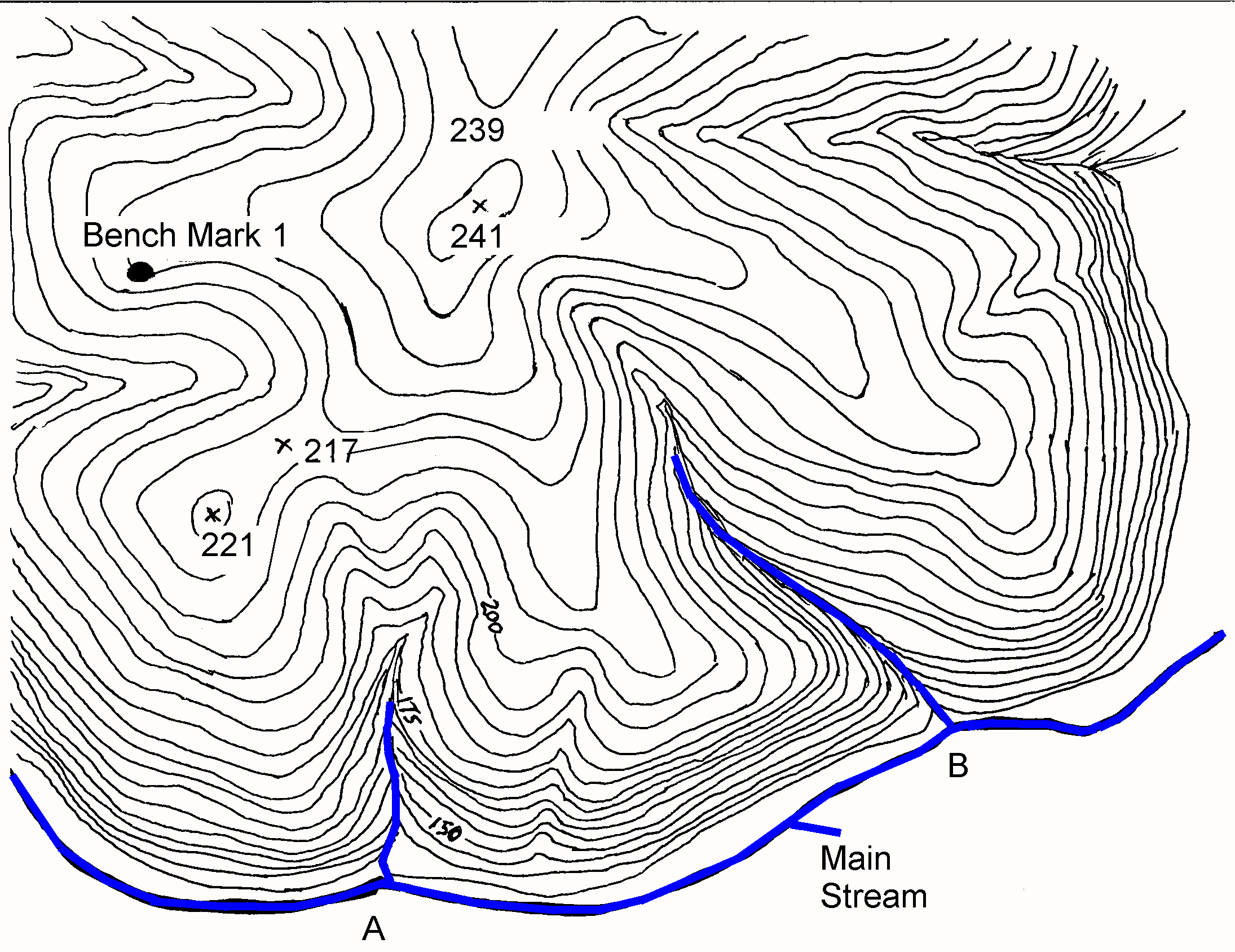
Question: What is the elevation of the benchmark?
Return to the Basic Hydrologic Concepts Menu of Lessons.
Updated 07/17/07