

4.2 Current Models
- Introduction
- Routing
- Reservoir
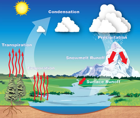
- Precipitation
- Etc.
 CHPS can utilize hydrologic and hydrodynamic models developed by the NWS, from other agencies, or academia. The following models are currently available for use in CHPS.
Keep in mind, using some of these models may require a General Adapter. The previous pages describe the purpose of the General Adapter (GA) module information on writing them.
Note: Specific details and explanations about each of the models listed in the chart above are beyond the scope of this course. Please visit the Deltares Delft-FEWS Configuration Guide for information on other models.
 LAG/K, SARROUTE, LAYCOEF, MUSKROUT, TATUM are all NWS-developed hydrologic routing models.
GLACIER is an NWS-developed model for glacier routing.
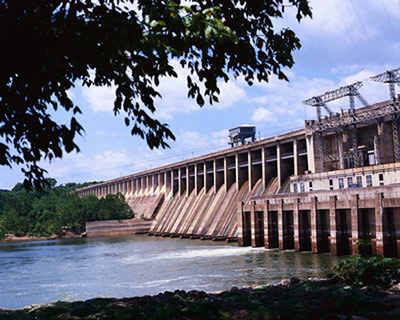 SSARRESV is a multiple reservoir regulation model, developed by the USACE and the NWS.
RESSNGL is an NWS-developed single reservoir simulation.
HEC-ResSim is USACE-developed single or multiple reservoir simulation.
 SAC-SMA, APICONT, and SACSMA-HT are NWS-developed rainfall runoff models. SACSMA-HT includes a heat transfer component.
RSNELEV and Snow17 are NWS-developed models. RSNELEV simulates the rain-snow elevation and Snow17 is a snow melt simulation.
SWMM is an EPA-developed urban rainfall-runoff model.
The NWS developed several other models, which are available in CHPS. BASEFLOW models baseflow, CHANLOSS simulates channel loss,
CONSUSE models consumptive use (diversions for agriculture, water supply, etc.), and Unit-HG simulates a unit hydrograph.
The USACE developed HEC-RAS, a hydrodynamic model and HEC-HMS, a hydrodynamic model.
Instructions: Click here to display regular course navigations once you have clicked on each tab.