

2.3 Add Segments
 After adding the new data source for ingest, make sure the workflows use the data and it appears in the Interactive Forecast Display (IFD).
Adding a new segment to a forecast group, like adding a new data type, adds new information to the river forecast process.
Adding a new segment also provides an opportunity to reevaluate how workflows are utilized in a forecast group.
Preparation
The first step in defining a new segment is adding a map for the basin. Use GIS to define the basin boundaries and create a new background map.
Save the file and log the filename and directory. Instruction on using GIS is beyond the scope of this course. Check out some of the resources on the ESRI page and the NWS GIS Data Portal.
Locate all pertinent information for the site, including name, site identifier, and data types associated with the location.
Configuration
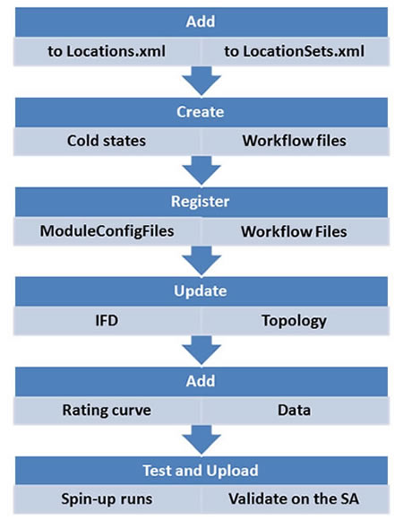
The next step is the configuration aspect of setting up a new segment. The job sheet below details all of the required configuration steps, but the graphic above is a general list of the necessary changes.
Use the job sheet below for details on how to configure a new segment.
Map the Workflow
The last step in the three-step process of adding a new segment is mapping the workflow. Open the Administration Interface and ensure the workflow for the new segment is mapped.
Unless this step is completed, CHPS will not recognize the new segment!
Job Sheet: Adding a New Segment