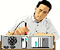
The Automatic Radiotheodolite, ART, is a ground-based radio direction finder that automatically tracks a ballon-borne radiosonde. The ART system antenna rotates to track the radiosonde transmitter to a distance of at least 100 miles. The radiosonde transmitter is a part of a package carried by the balloon that contains sensors to measure temperature, humidity and barometric pressure

ASOS, Automated Surface Observing System, equipment can be seen at airports throughout the country. ASOS is designed to support aviation operations and weather forecast activities and, at the same time, support weather observation needs of research communities. Among the sensing equipment are visibility sensors, precipitation identification sensors, ceilometers for cloud height determinations, temperature/dewpoint sensors, wind speed and direction instruments, and precipitation accumulation equipment. An ASOS group consists of some combination of these sensors.

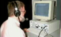
As part of the National Weather Service moderization plan many weather systems are being converted to UNIX platforms. Principle among these changes is the implementation of AWIPS, Advanced Weather Interactive Processing System. The AWIPS system will replace the AFOS system and will be used to integrate and display weather data for NWS Forecast Offices and River Forecast Centers. AWIPS at each site will consist of several networked Hewlett Packard UNIX systems. AWIPS systems are now installed at NWSTC. The vendor, PRC, will provide initial CUT training in the new AWIPS lab, over a two year period. NWSTC, has also set up a UNIX LAB for teaching various UNIX related topics in preparation for AWIPS and other UNIX-based systems.

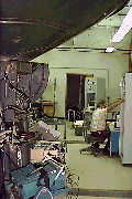
The NEXRAD system is an interconnected system of Doppler meteorological radars (WSR-88Ds) destined for approximately 175 sites throughout the continental United States, in portions of Alaska, Hawaii and Puerto Rico, and at selected overseas military bases. The radars are deployed strategically to optimize coverage and to form a complete and independent system including dedicated towers and radome structures, utilities, hardware, software, documentation, communications, logistics, training and support facilities. The acquired base data consists of measurements of reflectivity, mean radial velocity, and velocity spectrum width.
Go Back to NWSTC Home Page
Updated 11-15-00