
| {column0} |
3 of 5
Flood Inundation Mapping
Flood inundation maps provide a way to identify populations at risk of flooding in the Hydrologic Service Area.
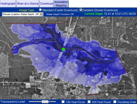 Flood inundation maps show the extent of the flooding given certain water levels.
Instructions: Click the image on the right to see if AHPS flood inundation maps are available for your area.
These maps are available through the USGS Flood Inundation Mapper application.
Remember, the Federal Emergency Management Agency (FEMA) is the official source of information supporting the Flood Insurance Program.
Some states, such as Georgia also offer digital flood mapping capabilities. Check to see if your state offers this service.