For a brief description of each of the current components of the WFO Hydrologic Forecast System (WHFS), click on the component name below:
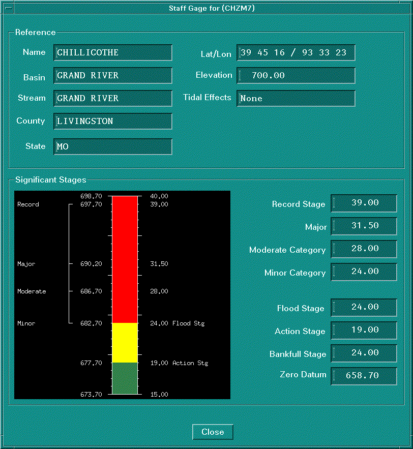
HydroBase is an interface to help manage data used by the various Hydrologic Forecast System Programs. Access to HydroBase must be restricted because of the importance of the managed data. The Service Hydrologist and/or Hydrologic Focal Point are responsible for maintaining the database. Much of the parametric data utilized by all the WHFS applications are also defined through HydroBase, eliminating the requirement for forecasters to manipulate these data during operations. Program management tools, such as information to generate the monthly flood stage reports, B-44, and E-19 have been expanded to include print capabilities. Since the same information is needed by both the WFO and RFC it is logical that they both utilize the same applications to view and update data. The major difference is that the RFC database will contain information from all the WFOs in their area. Real time data entering the WHFS is posted to the Informix database, typically by the SHEF decoder process
The Reservoir dialog was enhanced so that a user can associate dams from the Dam Catalog with reservoirs. There is a new button at the top of the Reservoir dialog. This button calls up a new dialog, Associate Reservoir. The Associate Reservoir dialog window allows the user to search the Dam Catalog for dams that might be associated with the reservoir in question. The search can be performed by using a latitude/longitude box or by using a name search. The search should yield a set of dams from the Dam Catalog, one of which ought to be the principal dam for the reservoir.
Currently, these two data sets (i.e., reservoir information and the Dam Catalog) are not related in the database because they originated separately. Reservoir information came from the SHIMS database and dam information came from the "National Inventory of Dams" CD-ROM.
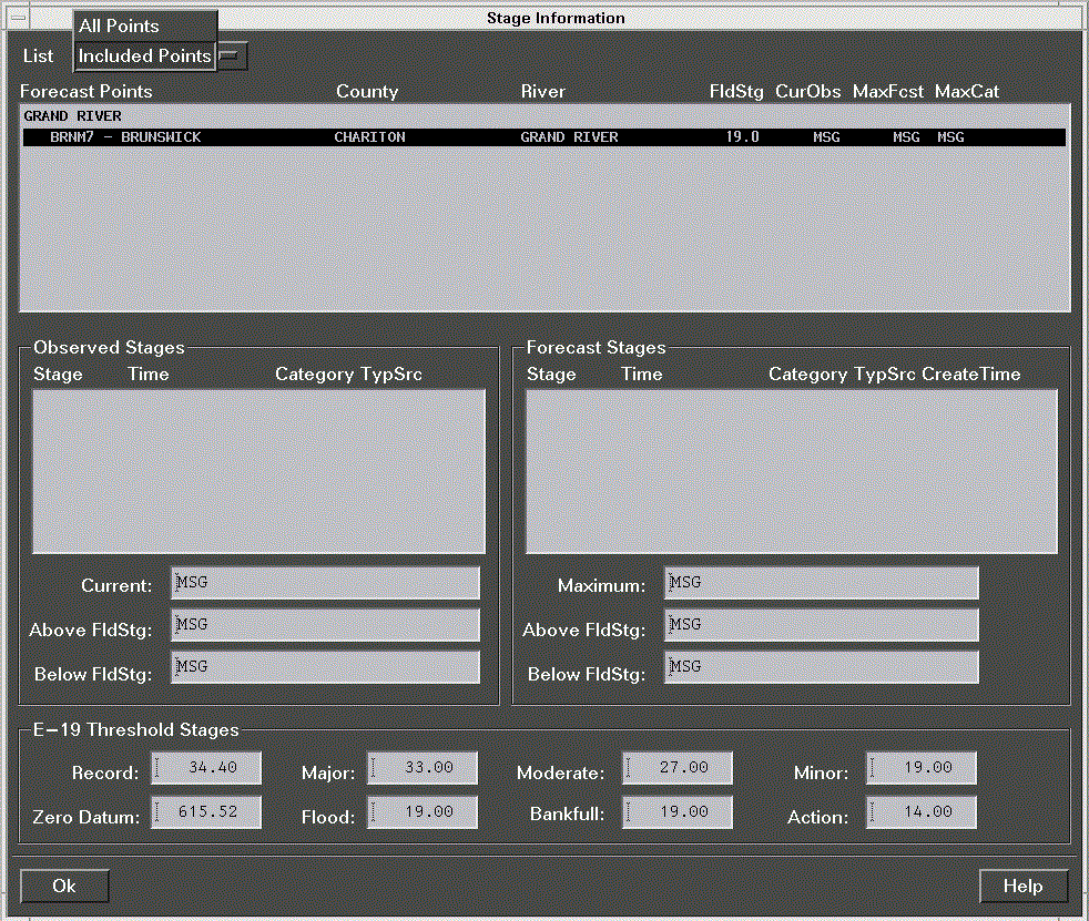
The RiverPro Forecast Groups/Points section allows the user to define forecast groups (as before) and to order the groups and their forecast points for tailoring the RiverPro display and generated products. This option allows the user to choose the primary stage parameter for RiverPro to use for each forecast point.

HydroView is the primary interface to the operational data contained in the hydrological database. It provides the forecaster with a geographical window showing the river stage and precipitation at locations in the WFO area of responsibility. Operational data, such as observed and forecast values, can be displayed in graphical or tabular form. Data are updated every 15 minutes from the Hydrologic Database so the forecaster is working with the most recent information. The data can be manually refreshed more often, particularily during rapidly changing hydrologic conditions. Data for the Flash Flood Monitoring Function consists of county, zone, and basin Flash Flood Guidance and precipitation estimates from Stage I radar products, Stage II gage-only analyses, Stage II gage-radar analyses, and basin QPFs. The Stage I radar data is the one-hour accumulation Digital Precipitation Array (DPA) grids available each volume scan.
In the Display Control Menu, one can access Point and Areal Data. Point Data includes:
Areal Data includes:
The key features of HydroView include:
The River Product Formatter (RiverPro)automates the generation and issuance of river statements (RVS), flood warnings (FLW), and flood statements (FLS) for locations within the WFO Hydrologic Service Area (HSA).
Upon starting the program, RiverPro extracts both static and dynamic data from HydroBase. Static data includes forecast names and their respective groupings, plus information found in data from Form E-19 (impact statements and historical crests). Dynamic data includes observed and forecast river stage data, plus carryover information that includes data from previously issued products for each forecast point. Carryover information from previous products is compared with current values to help determine the recommended product type.
RiverPro analyzes forecast and observed data, then determines derived values from stage time-series data. Using this derived information, the program automatically determines a recommended product to issue (for example, FLW) and the recommended forecast points to include.
The forecaster can either accept the recommendations or specify which product to issue and which forecast points to include in the statement or warning. RiverPro reads the instructions, which can be customized for generating the product. Then, the product can be generated, reviewed, edited and issued.