Inundation Map
 Another significant product which utilizes real-time ESP output data is a flood inundation map.
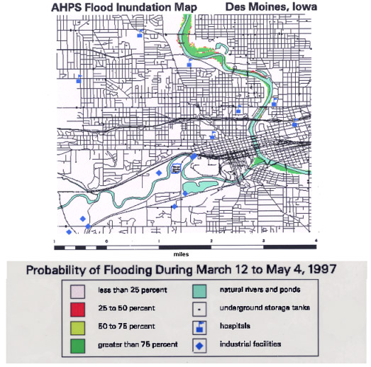
The inundation map depicts the probabilities that specific areas will be flooded during the identified event at a specific period.
The inundation map is based on the best digital elevation model (DEM) data available.
As DEM of greater resolution and accuracy become available, that data can be used with ESP to produce a more accurate flood inundation map which can then be used in NWS hydrologic forecasts.
To see more displays visit the AHPS
(Advanced Hydrologic Prediction Services)
section of the Des Moines, Iowa NWS Web-site
End of 'Ensemble Streamflow Prediction (ESP)'
 REFERENCES
 Can you recall...?
